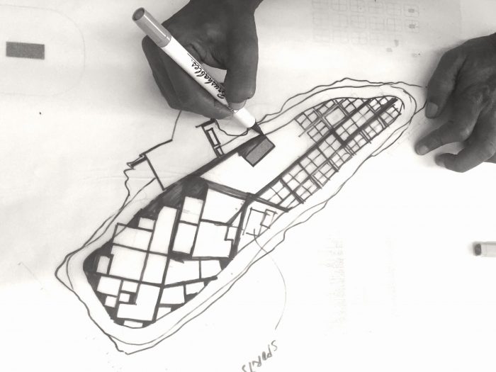
THE PROJECT
THINADHOO, VAAVU ATOLL
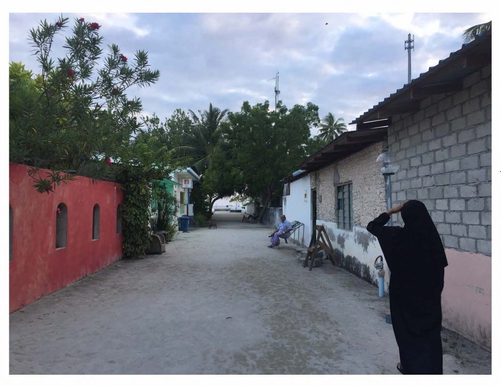
Once a thriving community located in rich fishing grounds, Thinadhoo island has seen the decline of its local population due to migration to Male’ and nearby islands. The current registered population stands around 200 while only 40-60 residents live in the island.
A large proportion of the island is covered in rich vegetation and the island’s surrounding healthy marine environment makes it an appealing habitat for the the development of a resilient, vibrant island community.
PLANNNING CONTEXT
Thinadhoo’s guest house tourism gained momentum in the past decade with approximately 200 beds established in seven guest houses to date. Investments in guest house tourism and related services are increasing. Service gaps exist in terms of municipal management and delivery of basic utilities such as power, waste management, water and sewerage. Past and existing land use planning efforts have proven limited in delivering integrated long term sustainability and the Thinadhoo Council remained unable to allocate land or invest in services without a proper Land Use Plan.
The central government administrations have been delaying allocation of plots for residential and other uses during the past decade. With the announcement of this new Land Use Plan project, the residents had high expectations for a speedy planning process and the Council faced urgent demand for allocating land for residential purposes and infrastructure development.
AN INTEGRATED LAND USE MODEL FOR VAAVU THINADHOO
Current conventions in land use planning segregate land allocation for major economic/commercial activities from general populations. The new Land Use Plan developed by MSPACE and Associates in consultation with Thinadhoo Council and community aimed to achieve integration of the island’s natural appeal as a tourist friendly place and its natural resources including its greenery, marine environment and historical identity by allocating land that will open opportunity for freer engagement in the economy by all residents, thus strengthening the social capital of V. Thinadhoo.
FUNDRAISING
The tender was awarded based on our proposition to utilise a fundraising model for the consultancy, with the Council contributing a nominal fee of MVR 10,000. The majority of costs and fees for the project were sourced through CSR funding and grant donations made by private donors.
PLANNING OVERVIEW
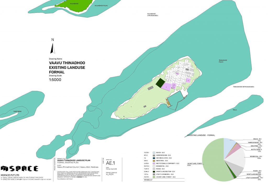
There are 206 people registered in Thinadhoo’s 12.7 hectare land. Altogether 42.8 percent of the land had been allocated for 37 house plots, administrative, socio-economic and industrial use and 7 hectares of forest area existed at the time of planning.
Several of these 37 residential plots are currently being leased out for operating guest houses and associated support services (cafes, water sports facilities, spa, kitchen and house keeping, staff accommodation, etc). At present there are 7 registered guest houses and 168 tourist beds in operation.
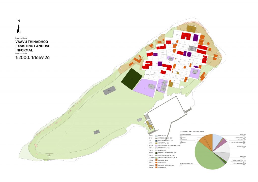
Some public areas and locations on the Environmental Protected Zone (EPZ) are currently being used for different purposes such as sun bathing huts and as outdoor dining cafes by guest houses, leading to the weakening of the natural green barrier on the island periphery. The following Existing Informal Land Use Chart depicts locations on residential plots and public areas.
![]()
ISSUES RAISED BY STAKEHOLDERS
The main issues raised in stakeholder consultations with Thinadhoo’s registered and resident populations, council, and related government authorities are as follows.
- Not to allocate specific areas of land for commercial purposes.
- To allocate as much space as possible for residential house plots after considering allocations for basic services and social infrastructure (altogether 71 people have applied to the council for housing).
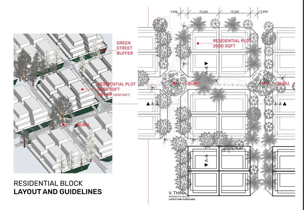
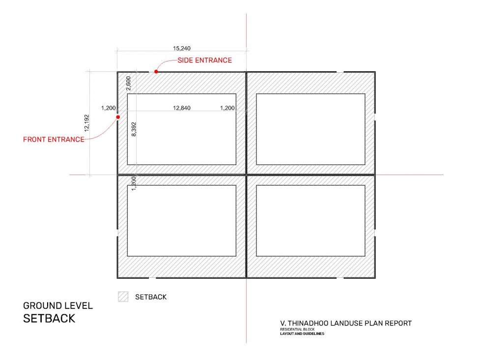
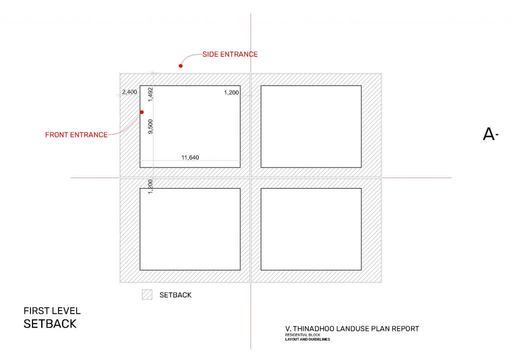
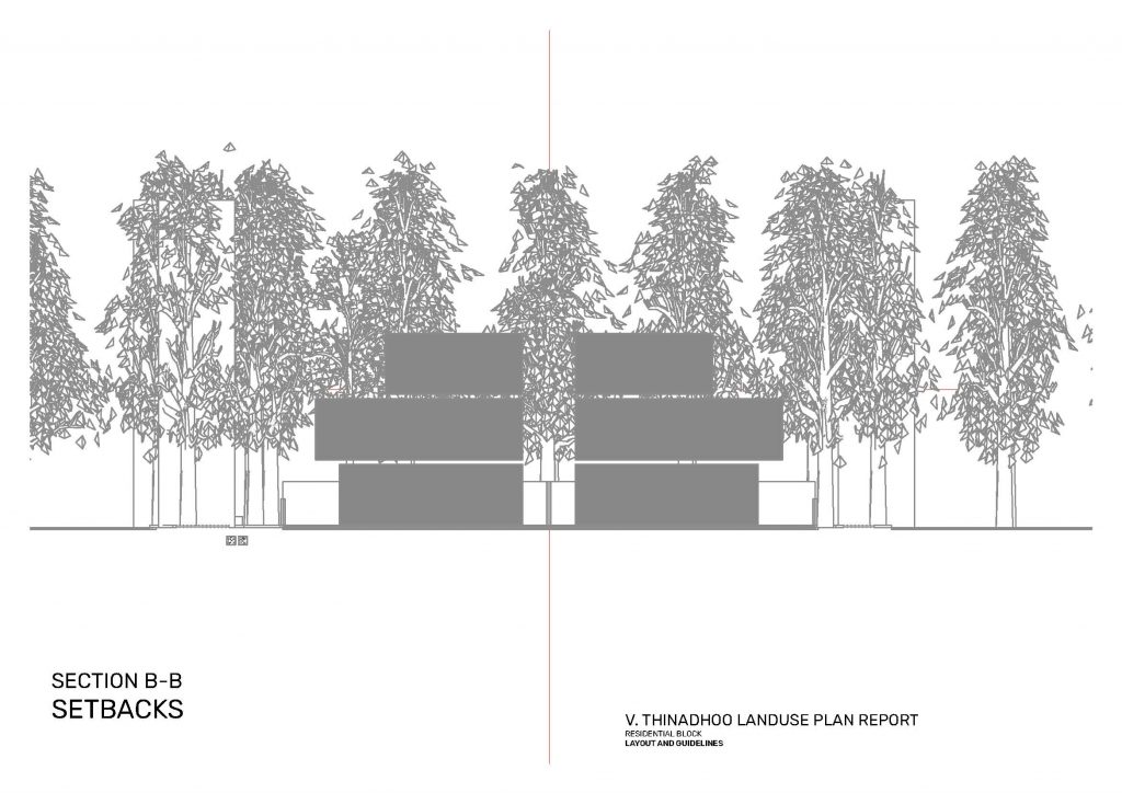
- To set the size of house plots at 2000 square feet (with 04 houses in each block).
- To limit the use of in motorised vehicles in residential neighbourhoods.
- To plan for a guesthouse friendly island community (with basic infrastructure and services such as water, sewerage, waste management and renewable energy)
- To plan for an island with an enlivened community and public spaces that accommodate residents of different age groups, opportunities for small businesses, jobs and education.
- To consider avenues for revival of the cultural identity of the island through guesthouse tourism (sports, traditional arts, heritage and entertainment).
- To identify the ideal carrying capacity of the island.
- To plan with consideration to projections on future tourism bed capacity, workforce, coherence with residential population, and sustenance of the island’s ecology.
PLANNING STRATEGY
The Land Use Planning Regulation of Maldives specifies planning for a 20 year period with provisions for social and economic sustainability of the community.
In reference to the issues raised by community and external stakeholders, as well as present circumstances surrounding the island’s guest house tourism economy, the new Land Use Plan aims to make provisions to accommodate above mentioned economic and social needs of the community. They include provisions for recreational public space, community social spaces, allocations for light economic/industrial use and infrastructure use, while allocating greenery reserves and marine blue zones for ecological health and sustenance of cultural identity .
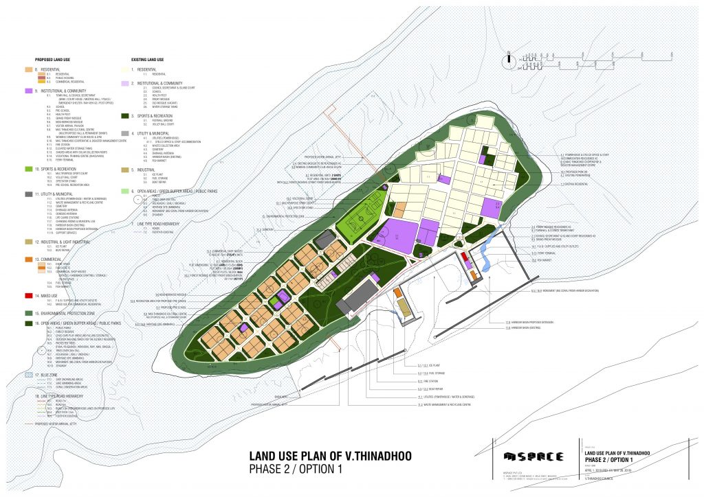
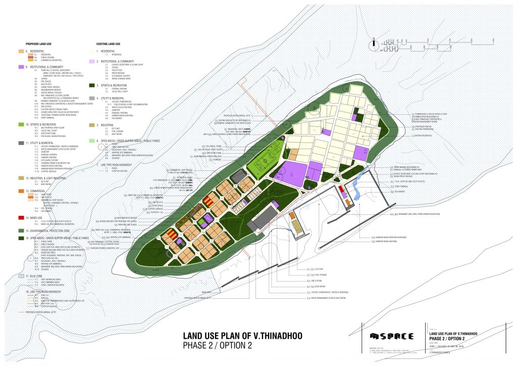
The new Land Use Plan thus proposes the following options in two phases under a 20 year Masterplan.
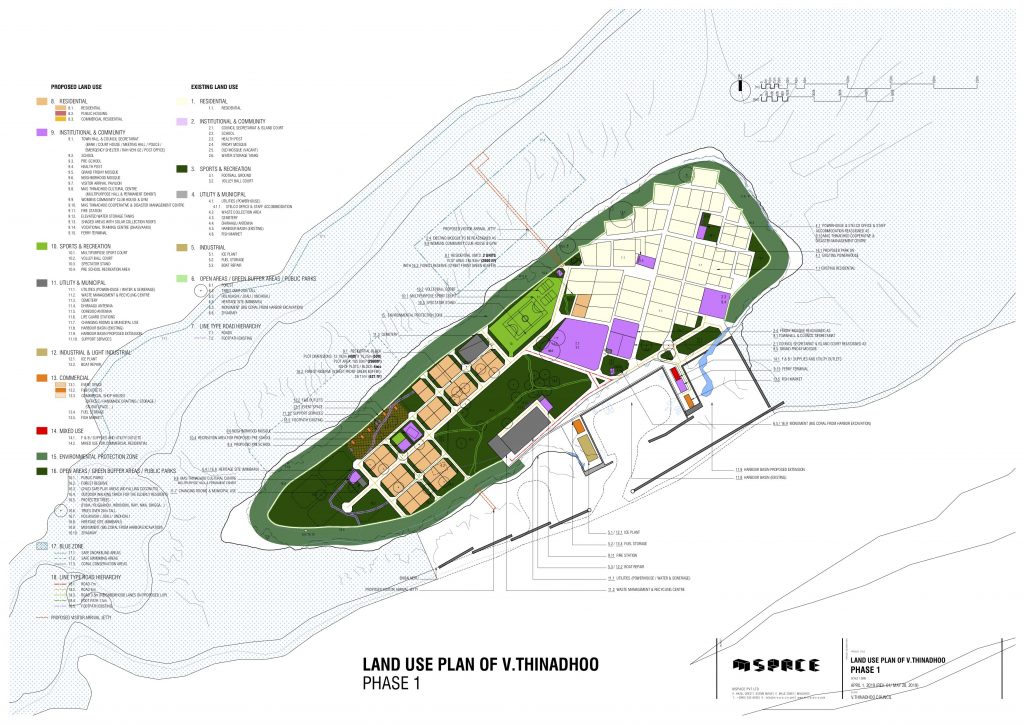
Proposed 20 Year Masterplan

Proposed Phase 1
Proposed Phase 2 : Option 1
Proposed Phase 2 : Option 2
The approved LAND USE PLAN Report (Dhivehi) is available for viewing. The plan was developed according to guidelines set under Maldives Land Use Plan Regulations.
It covers details on:
- Research and stakeholder consultations conducted over a period of five months
- History and current environmental, social and economic context of Vaavu Thinadhoo
- Findings based on individual surveys and stakeholders discussions
- Future projections for Thinadhoo
- The Land Use strategy and 20 year Masterplan
- Defined Land Use areas and justification
Planning Team
Mspace in partnership with Associates were awarded the consultancy project for formulating the Land Use Plan of Thinadhoo island in Vaavu atoll for a duration of 4 months.
Team members:
MSPACE
Adnan Ali – Project Lead: Transport / Civil Engineering
Mohamed Ishan Saeed – Urban Design / Architecture
Ahmed Ramie Rasheed – Architecture / Parametric Modelling
Ifham Niyaz – Communications / Research
Associate Specialists
Mohamed Zuhair – Environmental Planning
Aishath Niyaz – Sustainable Development / Climate Resilient Planning
Arshad Jameel – Socio-Economic Planning / Information Surveying
Farhad Mohamed – Parametric Modelling and Design
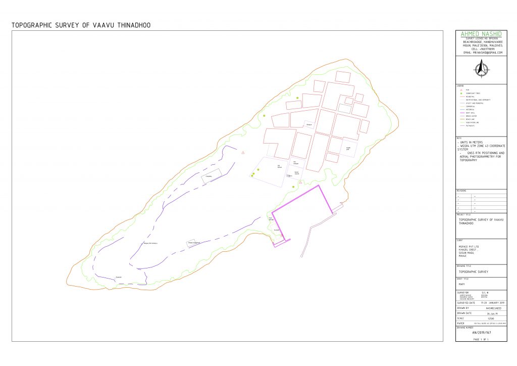
Ahmed Nashid – Topographic Surveying
STATUS UPDATE:
The Land Use Plan submitted to the Ministry of National Planning and Infrastructure by Vaavu Thinadhoo Council was approved after revisions on 16 June 2019.